Heritage Photograph Gallery
These are a selection of images from a collection compiled by Michael Adcock A local Blue Badge guide who is sadly no longer with us. We will be adding one or two new photos each week as we publish regular facebook updates
Early 20th century Herring Industry
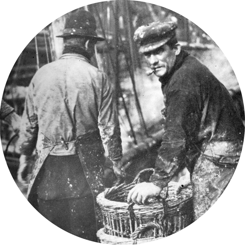
click the image to view the herring fishing gallery
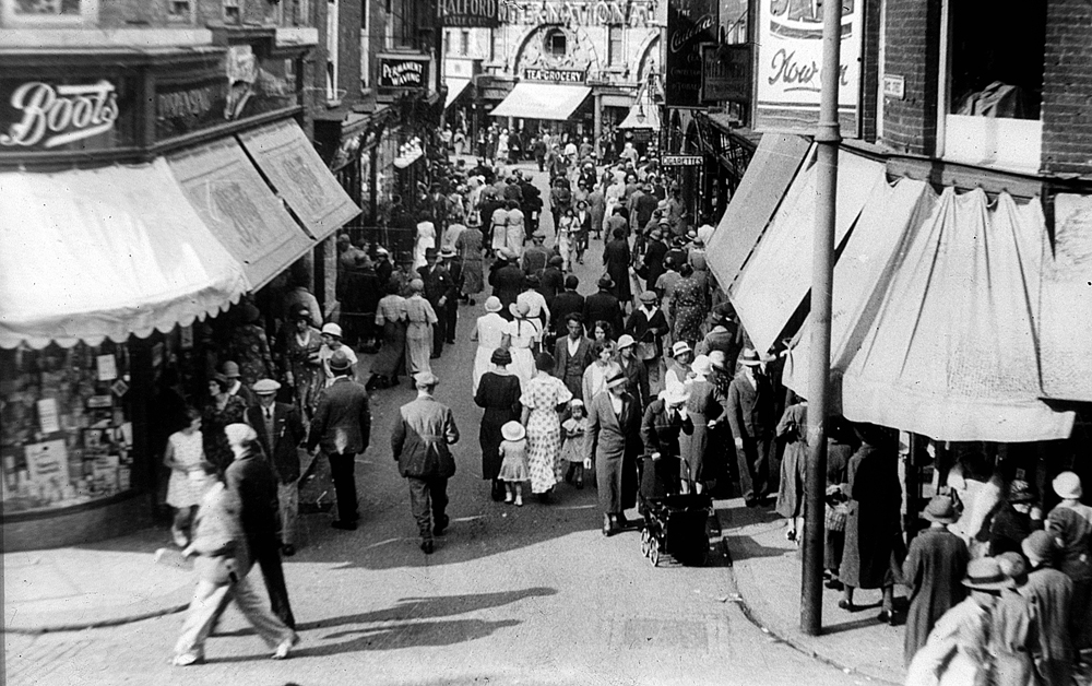
This image shows Brigg Street leading to the Haymarket. In the background we can see the distinctive façade of the Haymarket Chambers, occupied by the International Tea Company’s Stores (now the home of Pret a Manger).
This wonderful building, designed by George Skipper, was completed in 1902 for the grocer J. H Roofe who ran his shop on the ground floor.
It is interesting to consider the businesses on Brigg Street, some of which are still familiar to us today.
Most notable is Boots the Chemist which has a prominent corner site whilst we can also see a sign for the Halford Cycle Company.
Although we cannot make out their sign, R.G. Pilch (sports outfitters) are trading on the opposite side of the street.
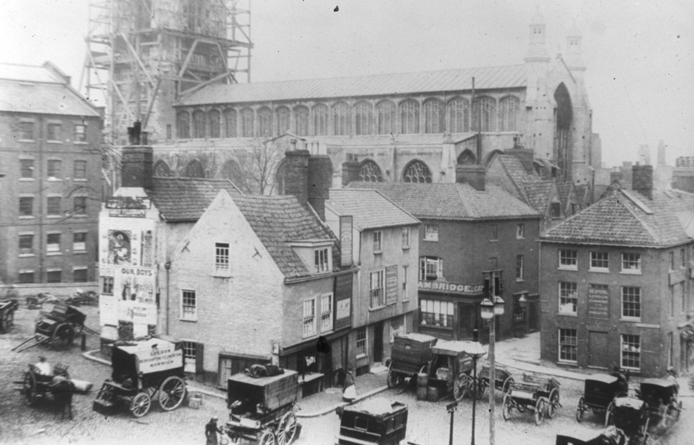
The evocative photo is of the Old Haymarket with the White Horse pub in the foreground and a scaffolding clad St Peter Mancroft behind.
The church website informs us: ‘The tower was crowned with the lead-covered fleche, stone parapet and pinnacles, by the Architect A. E. Street in 1895.’
As the scaffolding around the tower was almost certainly for that purpose, we can adjudge that the photo was taken around that date.
Looking at the image, the astute amongst you will have noticed that although there are a number of carts and carriages in the photo– it is somewhat bereft of horses.
Are they tucked away in a livery stable nearby or possibly in the White Horse which had underground parking or to be precise, a cellar, which an enterprising landlord had converted into stables.
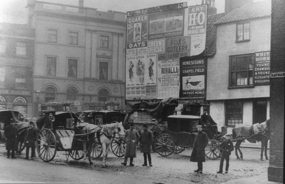
The White Swan buildings look somewhat more ramshackle and the premises next door is covered in billboards, suggesting it was taken after the first.
But not that much later, as we know that the licence was dropped in 1897 and the block of buildings demolished soon thereafter.
The area in front of the White Horse seems to have been subject to a change of use and use and is possibly temporarily operating as the taxi rank which was normally on the Walk?
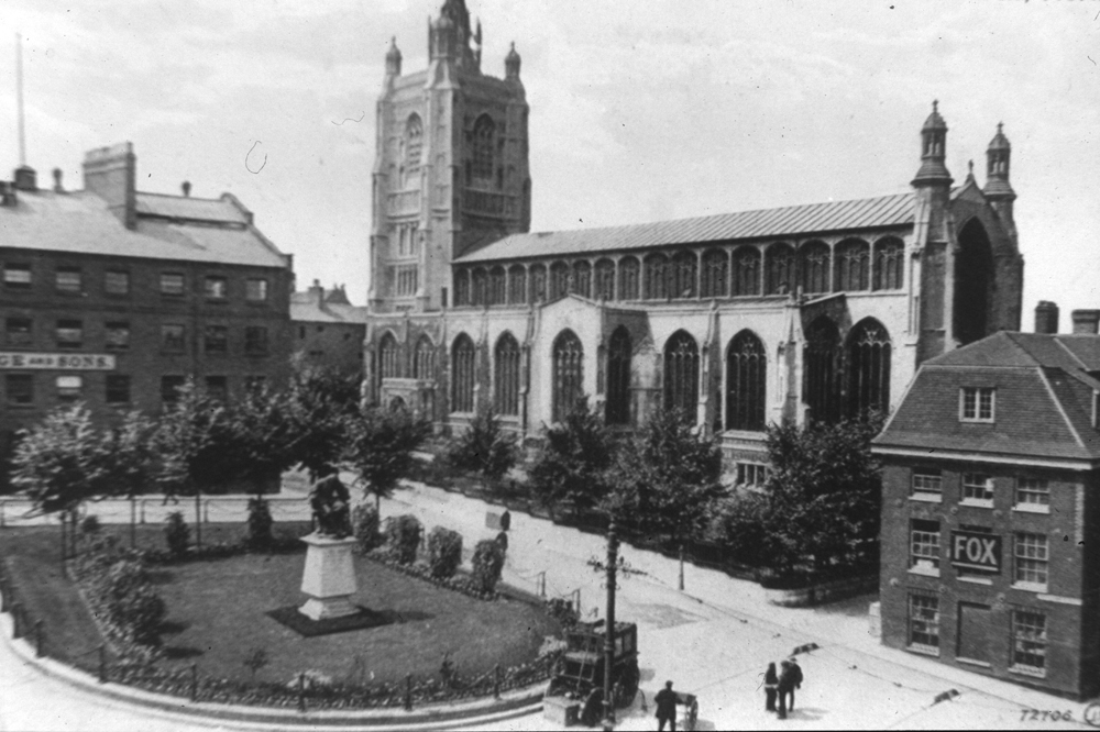
By 1905 the vista looks very different. St Peter Mancroft, complete with its refurbished tower, is fronted by a green in the centre of which is a statue of Sir Thomas Browne (1605 – 1682).
Although not a native of Norwich, Sir Thomas (described as a polymath - an individual whose learning spans many subjects) lived in Norwich from 1637 and practised medicine here until his death.
The statue is still there but somewhat sadly the green was replaced by the existing paving when C&A (now Next) was built in the 1970s.
We have recently posted images of old Norwich without following any particular structure.
However, we have noticed a thread running through these which we would now like to explore in more detail, namely: How have changes in transport impacted the City’s streets?
To do this, over the coming weeks we are going to post a selection of lovely photos, starting with those that feature trams.
Although this mode of transport operated in the City for a relatively short period of time ((1900 – 1935), they made a huge impact on the Cityscape – mainly because they ran on tracks.
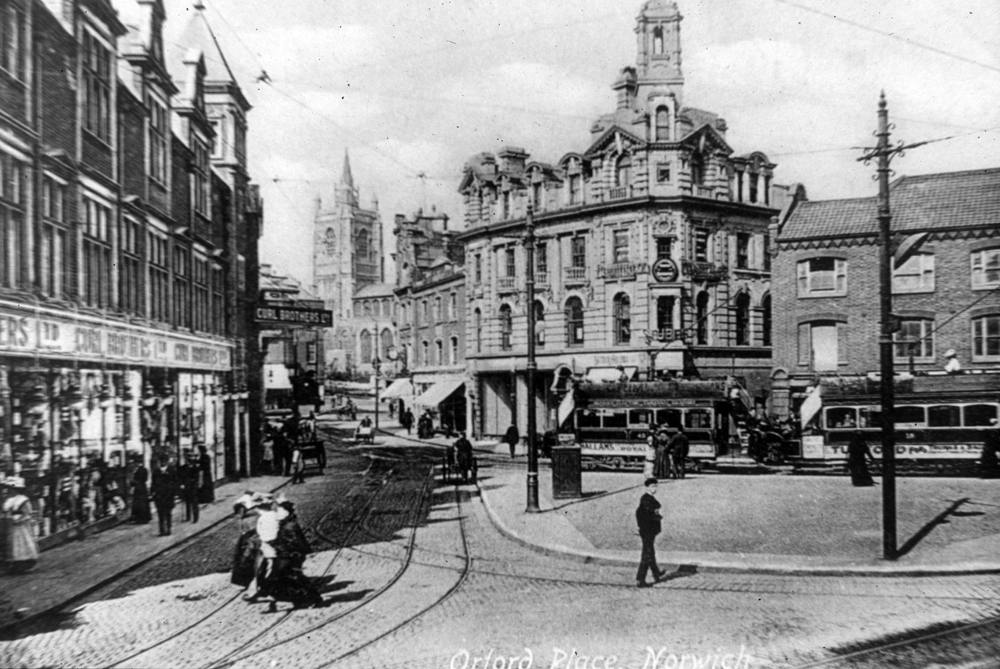
Our first picture features the bustling terminus on Orford Place, from here tram routes led from the City to the suburbs.
The buildings to the right of the image are still very recognisable today as, of course, is St Peter Mancroft which we can see in the distance.
However, the vista to the left and indeed Orford Place itself has changed beyond recognition.
In this lovely photograph we are treated to a view of Curls Brothers Department store, one of the City’s leading retailers.
The Curls family first purchased property on this block around 1860. Subsequently the store prospered and expanded,
in 1920 it was taken over by Debenhams and by 1929 occupied a floor space of some 51,000 square feet.
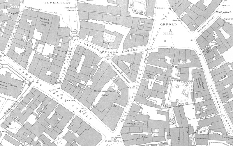
Comparing the image to the street layout evidenced by the 1884 OS map,
we can clearly see that buildings previously located on the ‘central island’ have been demolished and the roads running around its perimeter
(Red Lion Street, Rampant Horse Back Street and Little Orford Street) have been widened to facilitate the track
In April 1942 disaster struck when the entire block on which Curls stood was destroyed by enemy bombing.
The store was not rebuilt until 1956, the delay being caused by the Council wanting to widen Brigg Street, Rampant Horse Street and Red Lion Street – to facilitate a new form of transport – the motor car.
Unsurprisingly, as such a scheme would have reduced the size of the store by 1.5 acres, it did not find favour with the owners.
Eventually compromise was reached, which included Curls’ building over most of Orford Place (which is now a narrow thoroughfare) and extending to some four storeys plus basement.
The new store extended to some 97,000 square feet and was described as ‘dominating the shopping area of Norwich as the Norman Castle…once dominated East Anglia.’ .
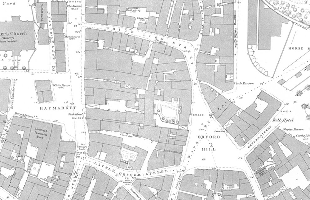
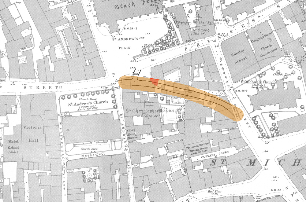
This portion of the 1883 O/S map clearly shows the enclosed nature of Orford Hill with no direct access to Castle Meadow
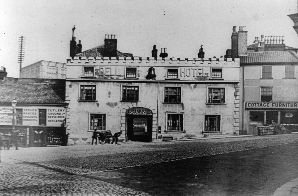
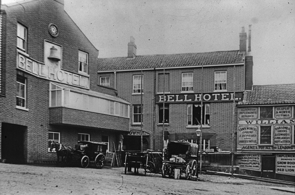
Our first photograph looking across Orford Hill towards the Castle features the Bell Hotel, a hostelry with had a long and chequered history.
Its claims to fame are many and are as diverse as launching the sale of bottled beer in Norwich (c.1750) and providing the HQ and billets for the American Women’s Army Corps.
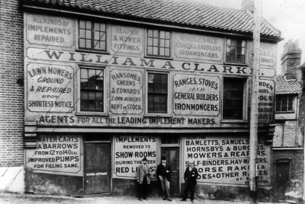
Despite major differences, the view is still recognisable today: but when was it taken? Our first clue is the existence of the ironmongers,
William A. Clarke, which occupies the premises next door (the subject of the second image).
As the entire building was demolished to make way for the City’s new trams which started running in 1900,
we have a pretty good idea it must have been taken before 1899 (even maybe a little earlier).
Our second pointer is the name ‘Downe’ which appears in the archway leading to the Bell’s courtyard.
As Jame Downe only took over the licence in 1891, this enables us to date the picture fairly accurately
Although not a leading coaching inn the Bell was a terminus for some of the more important local coach journeys.
For instance, the Norwich and Yarmouth Volunteer made regular runs from here to the Wrestler in Yarmouth.
Of course, such trips were consigned to history in the 1840s with the coming of the railway (the Yarmouth to Norwich rail route opened 1844).
On the same theme, it is probable that the handcart being pulled up the hill is transporting guests’ luggage from one of the City’s railway stations.
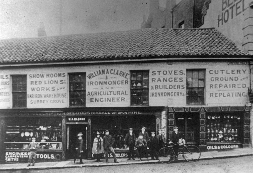
The second image shows William Clarke’s ironmongery which, as noted previously, was sacrificed in the name of progress.
As we can see the business offered a wide range of goods and services. Although it appears to be posed, what if anything, the individuals involved had to do with the shop is unclear.
For comparison we see the effect of cutting through from Orford Hill to Castle Meadow
There is a lovely vibrancy about the City, and aren’t the trams and cars superb? with the trams dominating the City’s streets.
It is also interesting to look at the smaller details, in particular the range of businesses advertised.
These include George Attoe & Sons the home furnishers that had premises on Stump Cross, Magdalen Street and Jewson & Son - another business known to us all today.
This is a rare late 19th century view of the courtyard of the Bell Hotel and the adjoining William Clark hardware shop.
We can just make out the name of the Bell’s licensee (Downs) above the arched entrance to the yard, and so assume that the photos were taken at the same time as the imagea we previously featured (between 1891 – 1899).
The shop was demolished c.1899 to form a cut through from Orford Hill to Castle Meadow.
It was a piece of precision engineering, as the buildings on either side of the hardware shop were retained, and still survive today.
As does the narrow York Alley, which forms a pedestrian way from Castle Meadow to White Lion Street As we can see William Clarke stocked an eclectic range of goods and provided many services.
When the photos were taken, he also had showrooms on Red Lion Street and a bar iron warehouse on Surrey Grove.
Unfortunately, we cannot trace what happened to William but it would be rather nice to think that he is one of the gentlemen posing for the photo.
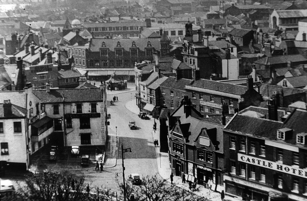
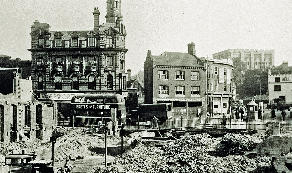
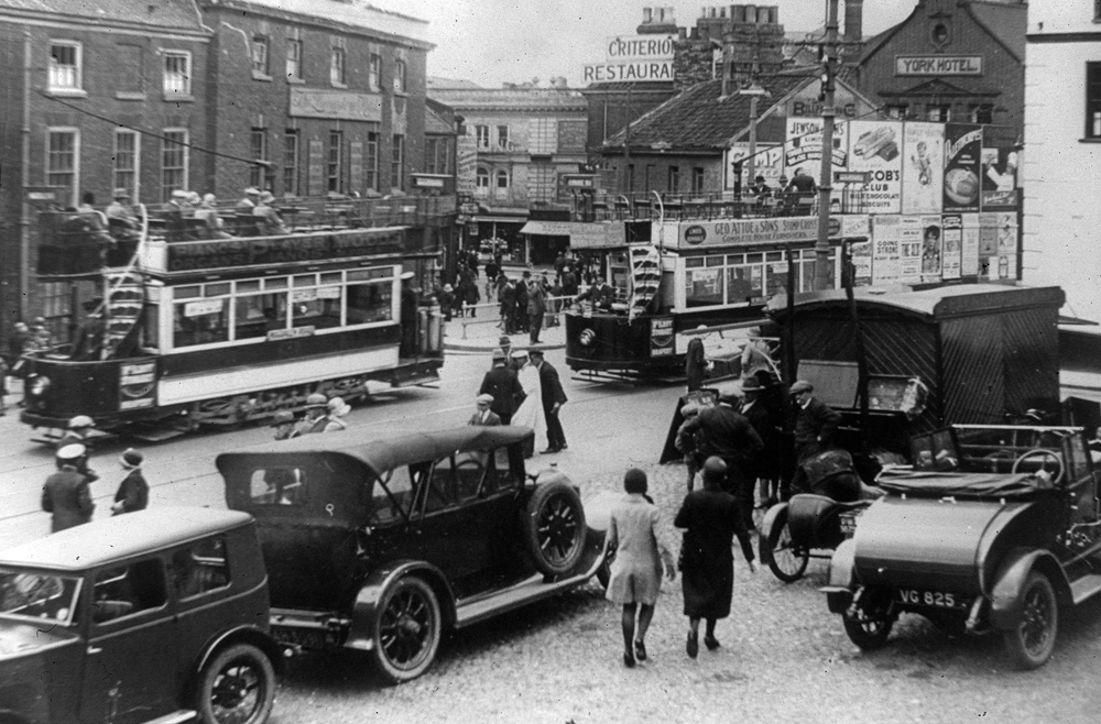
Fast forwarding to the 1930s, although the terminus is very much in evidence, our final image depicts the area after the demise of the trams.
In the background we can see Curls Department store and in the foreground the Bell.
The former Bell courtyard is no longer occupied by horses and carts/carriages, instead there is a car park.
Unlike today, the Bell itself still occupies the entire building.
Since the 1960s the Bell has had mixed fortunes.
In 1989, after being sold to a property developer, many thought the end was nigh for this ancient hostelry.
But although part of the building was taken over by a financial institution, the main area was redeveloped by J.D Weatherspoon chain, as its first Norwich operation (opened 1993).
Although the courtyard area has vastly changed and now houses an attractive seating area,
three features from the early photo have been retained: the bell, the clock and the wonderful lettering proudly displaying the name ‘BELL HOTEL’.
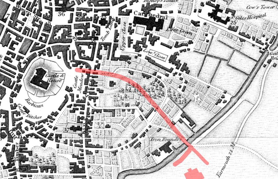
One of the many challenges facing the engineers planning tram routes through the City was how (and indeed where) to run the track between Castle Meadow and St Benedict’s.
In our next couple of posts we will look at how this was achieved. It is best illustrated by using the 1884 map where the new link has been marked in orange.
As can be clearly seen the planners didn’t let trivialities, such as buildings, get in their way.
These pictures show the scene on Redwell Street before, during and after the reconfiguration.
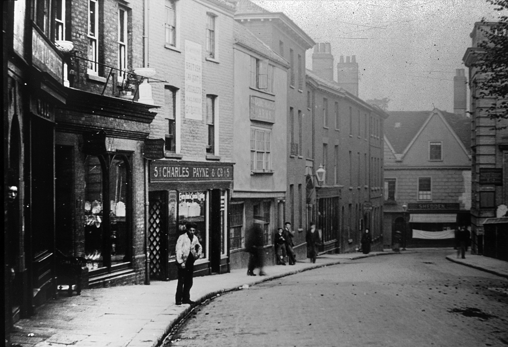
We can clearly see that number 5 is occupied by Charles Payne & Co, who we know from trade directories were gas and hot water engineers.
We can then just make out that its neighbour at number 6 is the Cabinet Makers Arms,
which stands next door to an imposing three-storey building which was the home of the rector of the nearby St Peter Hungate (Princes Street).
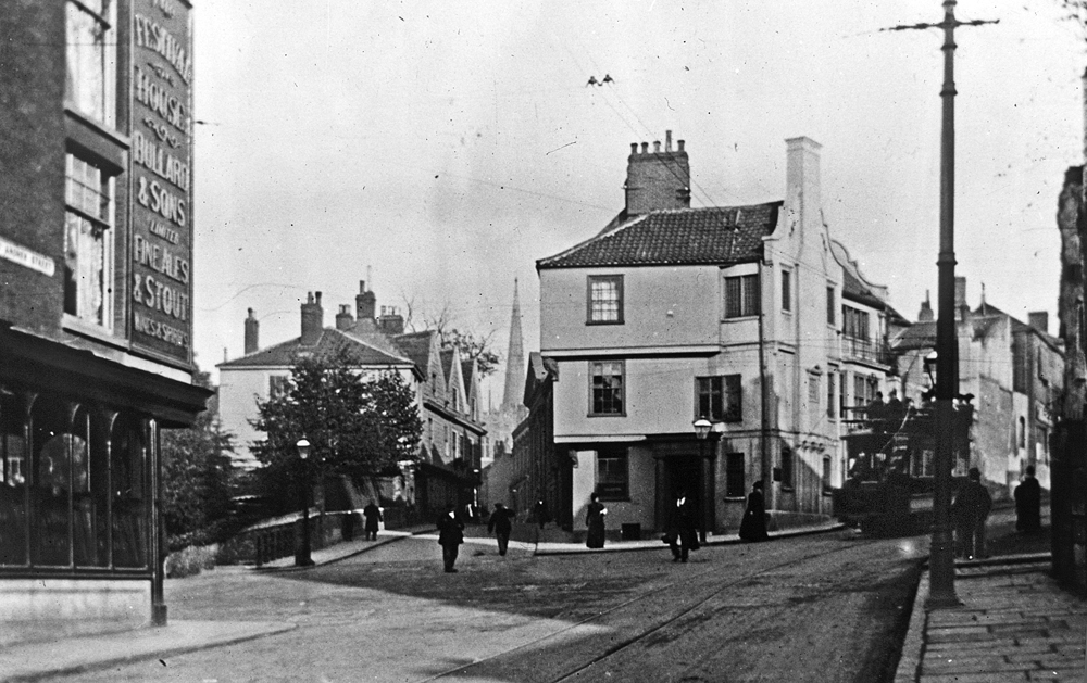
Numbers 6 and 7 were demolished around 1898 to make way for the track which ran in a huge curve linking Redwell Street and St Andrew’s Street.
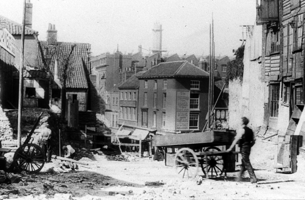
Our work in progress image, looking from the direction of Redwell Street down St Andrew’s Street towards the Festival House pub, shows the devastation wreaked in the name of progress.
It is interesting to see the basic equipment used by the workmen.
Also note in the background a huge factory building which housed Harmer’s clothing factory (now the approximate location of St Andrew’s car park).
This building wasn’t destroyed by the City’s planners, but by the Luftwaffe.
The second picturesque image, which looks somewhat posed, shows the scene after the alteration.
We can clearly see both the tram track and the overhead wire. What is less clear is the fact that number 6 was rebuilt and extended.
The license from the Cabinet Arms was then merged with the license of the City Arms (which had previously been located on St Andrews at the other end of the new track and had been demolished at the same time).
The new premises, also called the City Arms, traded on until 1958 after which it was removed to make way for the Eastern Counties Newspapers grand new edifice, which today houses the University College of the Arts.
Thist image shows the streetscape before the building of the tramlines – an area soon to be subject to significant change.
The imposing 16th-century four-storey building jutting onto St Andrew’s Plain was the home of the City Arms pub owned by Lacons of Great Yarmouth.
Behind the City Arms we just get a glimpse of Garsett House formerly known as Armada House. Built around the same time as the City Arms,
this Tudor building survived the trams, though it did have the misfortune to lose part of its south wing, leaving it slightly misshapen.
Less obvious was the slight alteration made to St Andrew’s Churchyard, where a small piece of land was lowered.
Builders working here are reported to have collected seven basketfuls of human remains from the site.
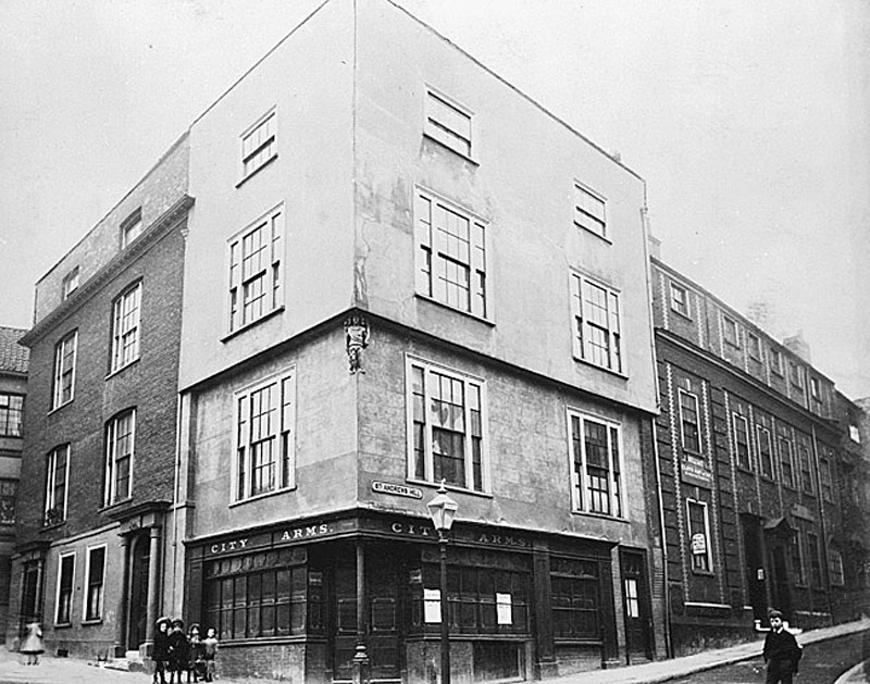
The Norwich Electric Tram Company had paid £2573 for the C'ity Arms premises, a popular venue largely used by ‘musical people, fishing clubs and other societies’.
An application to open a new public house on the corner of St Andrew’s Hill and the new cut through was rejected –
largely on the grounds that there were already nine public houses within a radius of l00 yards and a staggering 19 within 150 yards.
Instead, as noted previously, the licence was merged with the Cabinet Makers Arms (Redwell Street) and transferred to a new premises.
Despite the destruction wrought on this area, one positive aspect of the street reconfiguration was that the medieval Suckling Hall was brought into view.
Though over the years it has been subject to many renovations, the oldest surviving parts of this former merchant’s house date from the early 14th century.
Of course, it is now the home of the popular Cinema City.
This image shows an attractive scene after the work was completed. A view that is still recognisable today.
Longman's map of Norwich 1819.
It can be seen that this area was largely horticultural which meant that building Prince of Wales Road did not necessitate the demolition of buildings. The dotted line that is now the Yarmouth Road appears to still be in the planning stage but the Millard and Manning map of 1830 shows it as a completed road.
It can be seen that this area was largely horticultural which meant that building Prince of Wales Road did not necessitate the demolition of buildings. The dotted line that is now the Yarmouth Road appears to still be in the planning stage but the Millard and Manning map of 1830 shows it as a completed road.
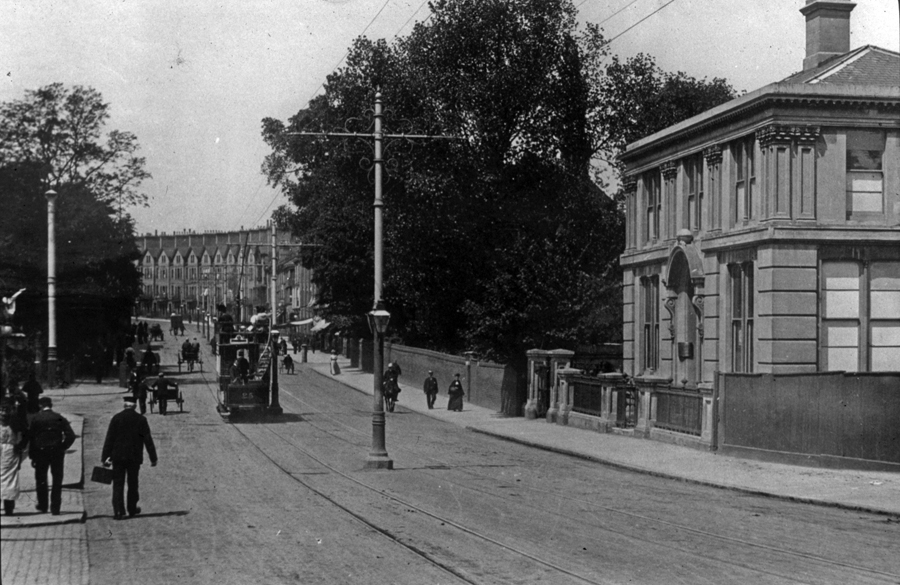
The first scene dates from c.1900, just after the trams start to run.
At the top of the road, we just catch a glimpse of a row of large houses with low-pitched gables (described rather unkindly by the architectural historian Pevsner as resembling ‘an unimaginative seaside terrace’) which still line the street. It had originally been hoped that buildings of a similar design would continue down the road and become high-class residences – neither aspirations were realised. In fact, when this photo was taken we can see that south of St Faith’s Street there seems to be just one building fronting Prince of Wales Road. We know the building is no longer there – but what was it? It was in fact part of the Hills & Underwood Distillery and Vinegar Works, which, as can be seen on the 1884 map, occupied a huge area. A vinegar works had first been established on this site in 1762, and it remained here until 1911 when the works were closed and subsequently demolished.
At the top of the road, we just catch a glimpse of a row of large houses with low-pitched gables (described rather unkindly by the architectural historian Pevsner as resembling ‘an unimaginative seaside terrace’) which still line the street. It had originally been hoped that buildings of a similar design would continue down the road and become high-class residences – neither aspirations were realised. In fact, when this photo was taken we can see that south of St Faith’s Street there seems to be just one building fronting Prince of Wales Road. We know the building is no longer there – but what was it? It was in fact part of the Hills & Underwood Distillery and Vinegar Works, which, as can be seen on the 1884 map, occupied a huge area. A vinegar works had first been established on this site in 1762, and it remained here until 1911 when the works were closed and subsequently demolished.
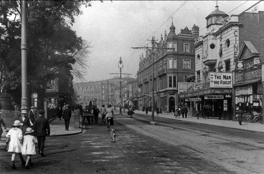
South of St Faith’s Road, buildings now line Prince of Wales Road. Of particular note is the Electric Theatre.
Opened in 1912 this was Norwich’s second purpose-built cinema.
As it is featuring the film ‘The Man Who Forgot’ (starring James Knight and Marjorie Villers) we can fairly accurately date the image to 1919.
On the opposite side of St Faith’s Road we see Alexandra Mansions, designed by Edward Boardman in 1889 as Norwich’s first -purpose built flats.
Similar to the terraces at the top of the Road, its aspirations to become a prestigious address were never realised, perhaps not helped by the fact the ground floor had always been intended for commercial use.
In 1923 part of the building was converted into the foyer of what was originally the Regent Theatre (the theatre itself was constructed behind).
It later evolved into one of Norwich’s great dream palaces of the 1950s/60s the Regent Cinema (part of the ABC chain)


